
GeoTreallús Dhúiche Sheoigeach agus Lochanna an larthair/Joyce Country and western lakes Geo enterprise
Geoparks help to tell the fascinating stories of geological, social, cultural and economic history of specific areas. They also help to promote and secure broad-based, sustainable social and economic development in their specific territories. There are now over 120 geoparks worldwide. Elevated to UNESCO status from 2015, they have equal status to World Heritage sites but do not carry any legislative weight and don’t impose restrictions on people, landowners or industry.
The idea for a Joyce Country and Western Lakes Geopark emerged in 2008 when a voluntary group identified that the rich geoheritage of the region could potentially be a catalyst for broad-based enterprise and social development in this often-over-looked area. The area primarily include the territory and landscape around the villages of Ballintubber, Partry, Tourmakeady, Finny, Leenane, Recess, Maam, Maam Cross, Kilmilkin, Clochbhreac, Cornamona, Oughterard, Cong, Clonbur and The Neale, and taking in all of Loughs Carra and Mask, and around half of Lough Corrib.
The Joyce country and western lakes region is host to a great variety of rock types and environments that are ideal for understanding the geological processes and the development of the Irish landscape. The area is roughly characterised by a contrast between the uplands of the Partry Mountains, Maumtrasna and the Maumturk mountains to the West and the undulating plains stretching into the Irish Midlands to the East starting at the shores of Loughs Mask, Carra and Corrib. Each of these lakes are famous for angling and their waters are all connected, flowing south into Galway Bay. The mountains of our geopark project rise to between 400 and 700m high and are broken up by glacially carved valleys, lakes, and many rivers flowing into the two larger lakes to the East and some into Killary Harbour, Ireland’s only fjord to the West. Our rural geopark project area is sparsely populated with a dozen villages and houses dotted evenly in between the mountains and the lake shores, the larger concentration of people is located to the east of the larger lakes on the plain.
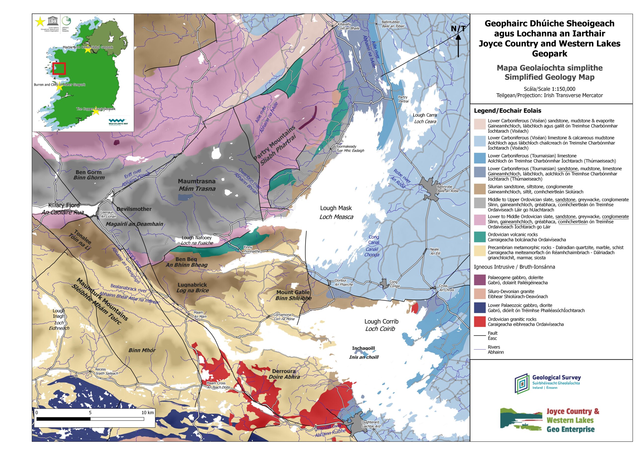
The mountains of Joyce Country are among the oldest in Ireland and formed when two halves of Ireland collided about 400 million years ago, deforming and pushing upward older sedimentary rocks. That collision came with volcanic activity and there is clear evidence of that in the rocks around Finny, Co. Mayo. 100 million years later Ireland, then sitting in the tropics, offered a landscape akin to the Great Barrier Reef today with the development of the very common grey limestone filled with fossil evidence of its rich biodiversity. The Ice Age has had a critical influence on the landscape with the flattening erosion of the limestone, allowing the formation of our great lakes, and the shaping of valleys in the mountains and drumlins on the plains. After the ice, plants, animals and eventually various waves of human population settled here with the Joyce clan giving its name to the region in the Middle Ages.
Simplified Geology Map of the proposed geopark area (source: Benjamin Thébaudeau, JCWL geologist) [see attached]
Further information at www.joycecountrygeoparkproject.ie
No Comments
Add a comment about this page