Knockma LiDAR Project Visual Renderings


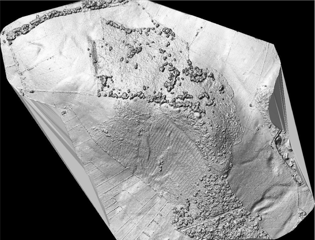
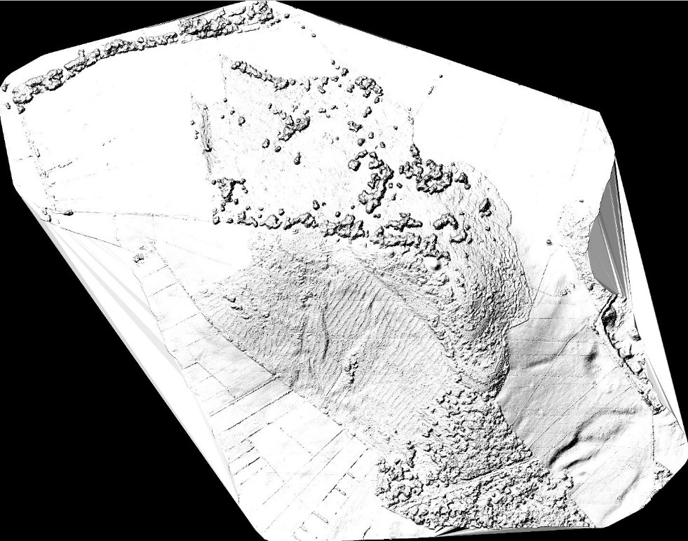
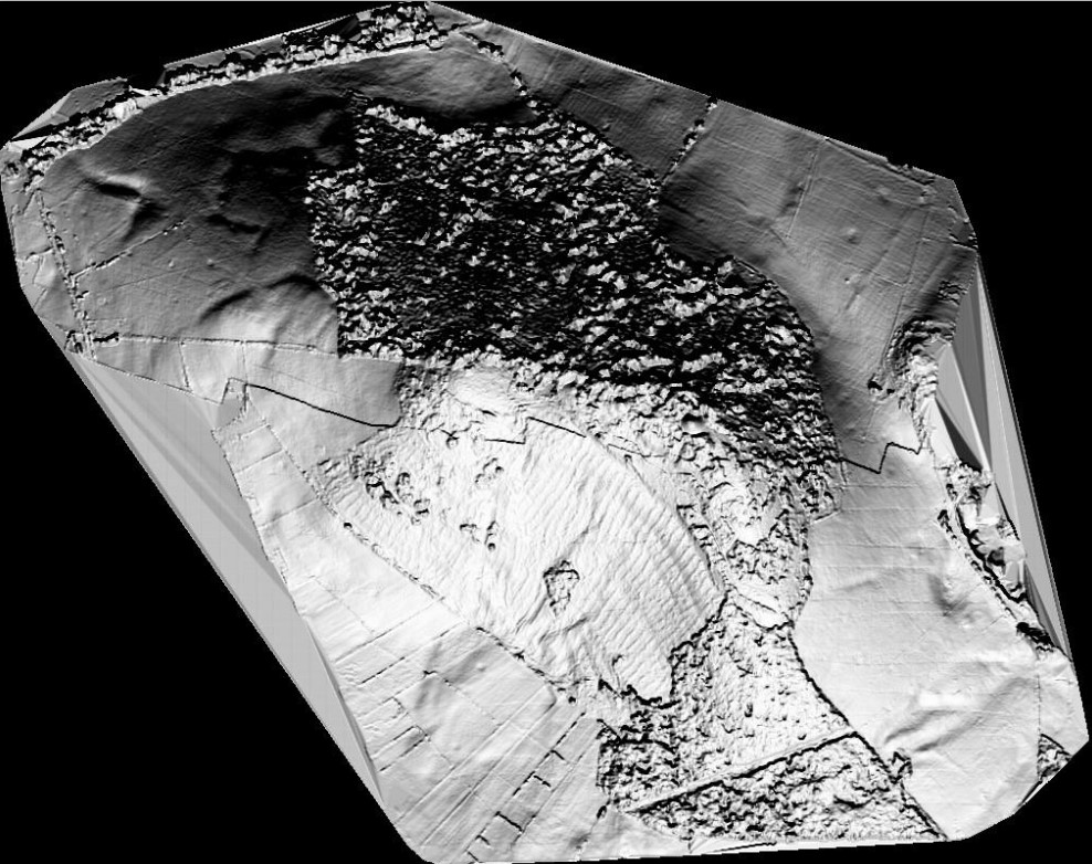
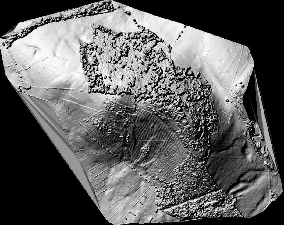
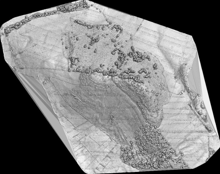
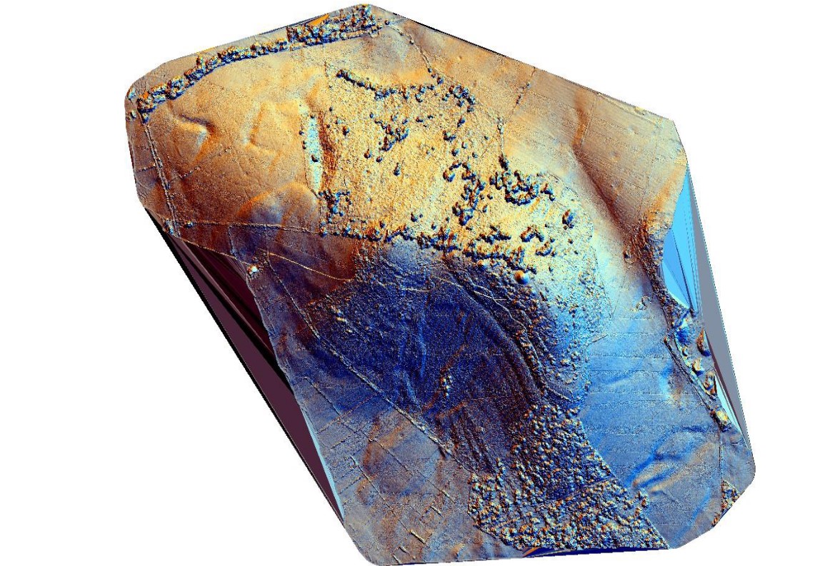
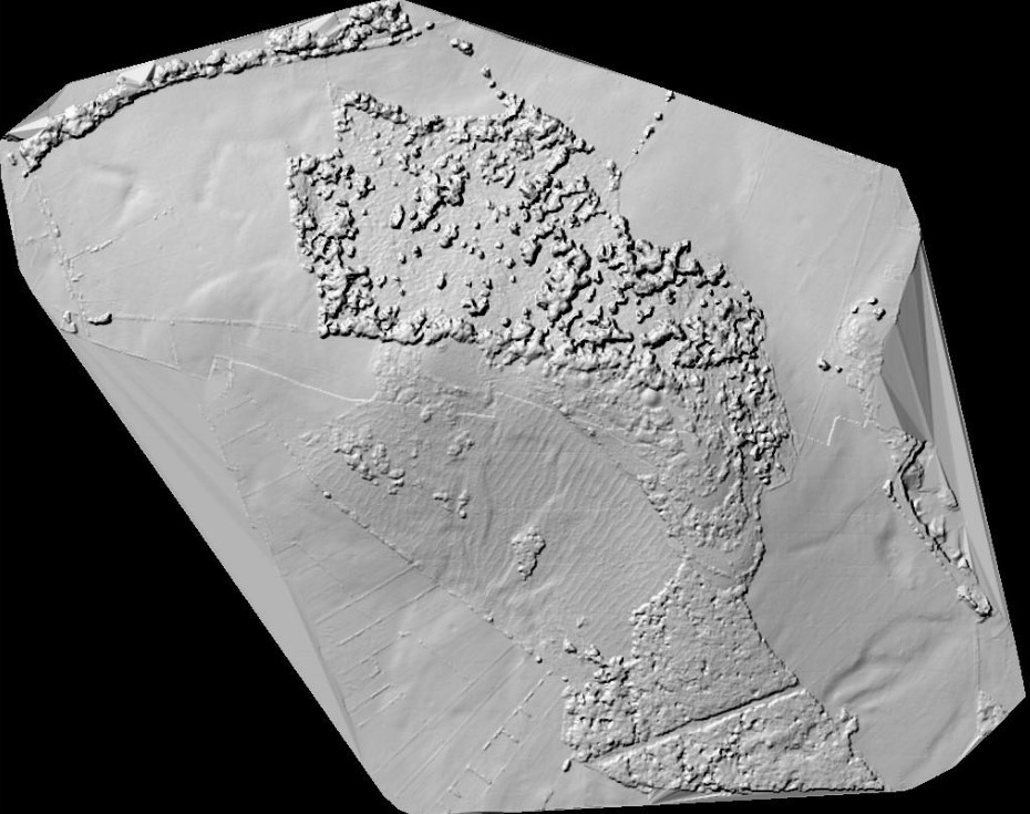
In the spring of 2024, the Donaghpatrick Kilcoona Heritage Society were awarded grant funding through the Heritage Council Community Heritage Grant Scheme 2024 to conduct an aerial LiDAR survey of Knockma. This allowed, for the very first time, for the compilation of a comprehensive map of the hill, showing its archaeological features and how they were positioned in relation to each other and to the natural contours of the landscape.
Onboard the project was Dr Paul Naessens of Western Aerial Surveys, a highly experienced archaeologist and landscape surveyor, who conducted the survey using the very latest remote technology, collecting an immense amount of raw data which he has used to produce these initial maps of Knockma Hill.
Paul, along with Dr Jessica Cooke, an acclaimed scholar of medieval history and archaeology, and Irene McGoldrick, Chair of Annaghdown Heritage Society, are currently using the maps and interpreting the data to help us examine this important royal and ritual site.
The data produced by the survey is also open to the public, for anyone else who would like to help in better understanding Knockma Hill, and you can contact the Donaghpatrick Kilcoona Heritage Society via email to learn more: [email protected]
During Heritage Week 2024, the Society invited both Paul and Jessica to a public presentation of the project to date, which can be accessed above.
No Comments
Add a comment about this page