Ballydonnellan Monuments


")
")

National Monuments Service
According to the National Monuments Service there are four ringforts, a souterainn, a mound, and a sweathouse located in Ballydonnellan townland. There is also a circular house in ruins, and one other house listed without detail.
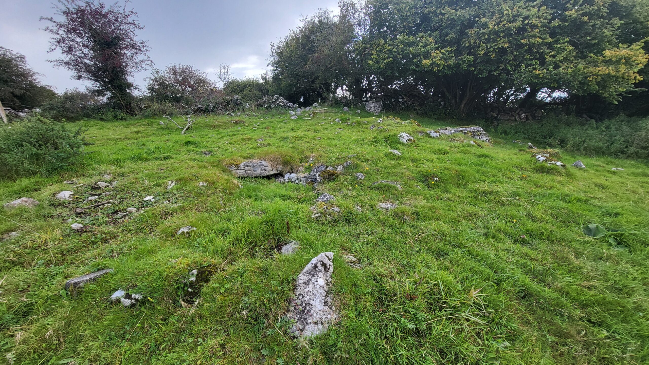
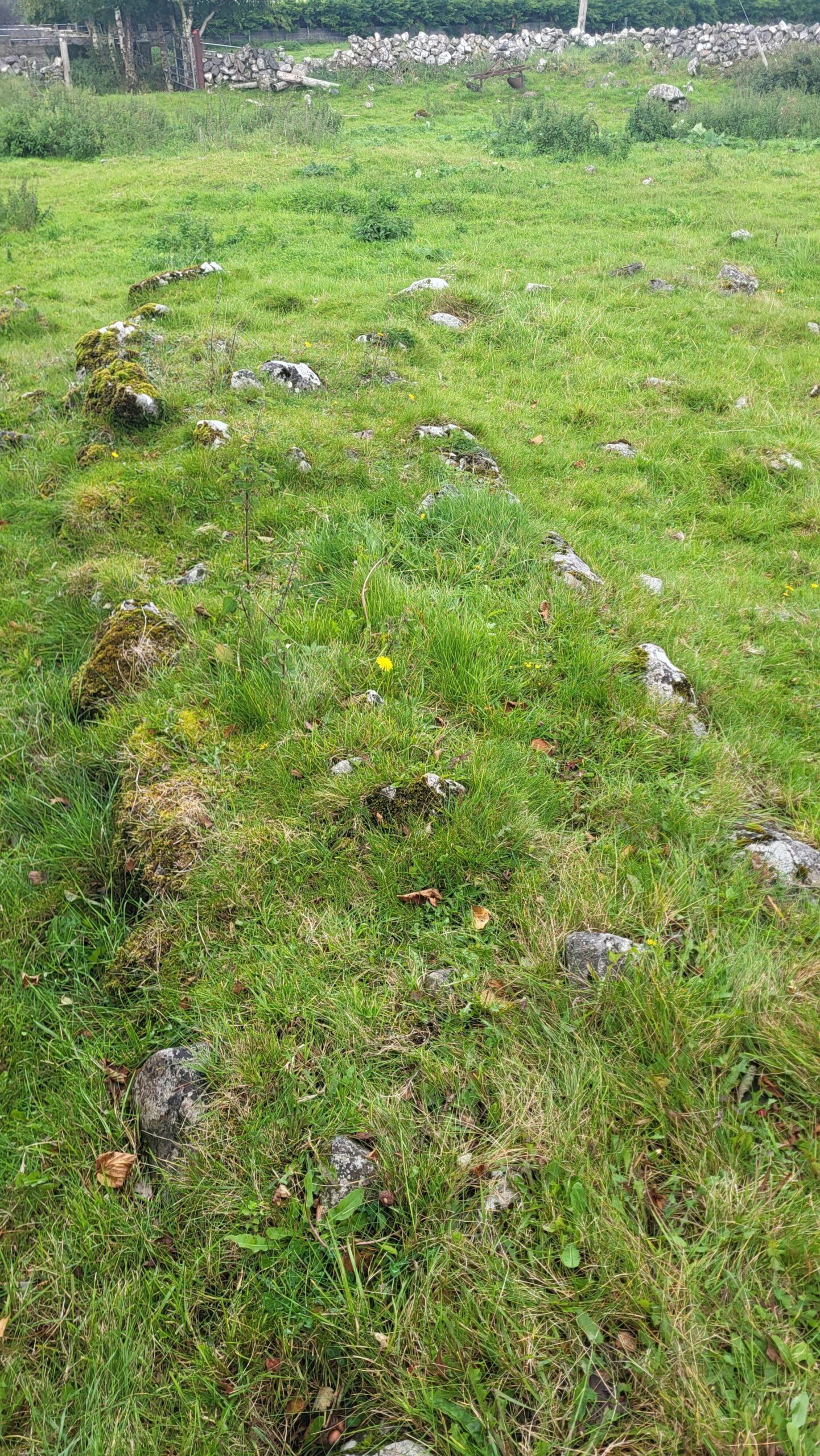
Ringfort (GA056-013—- )
Situated in grassland. Circular cashel (D 37m), in fair condition, defined by a collapsed drystone wall overlain throughout by a field wall. Numerous gaps in the enclosing element appear modern. There is a souterrain (GA056-013001-) in W half of the interior and just SE of centre is an irregular mound (E-W; L 9m, Wth 6m).
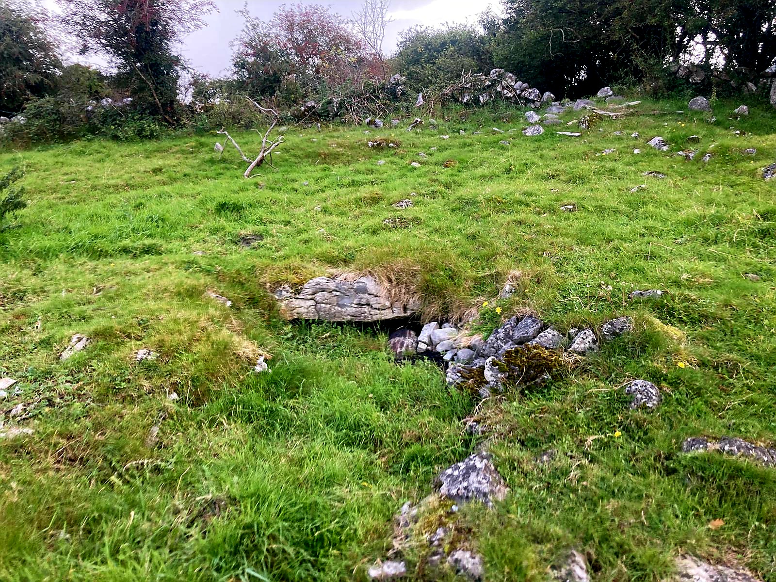
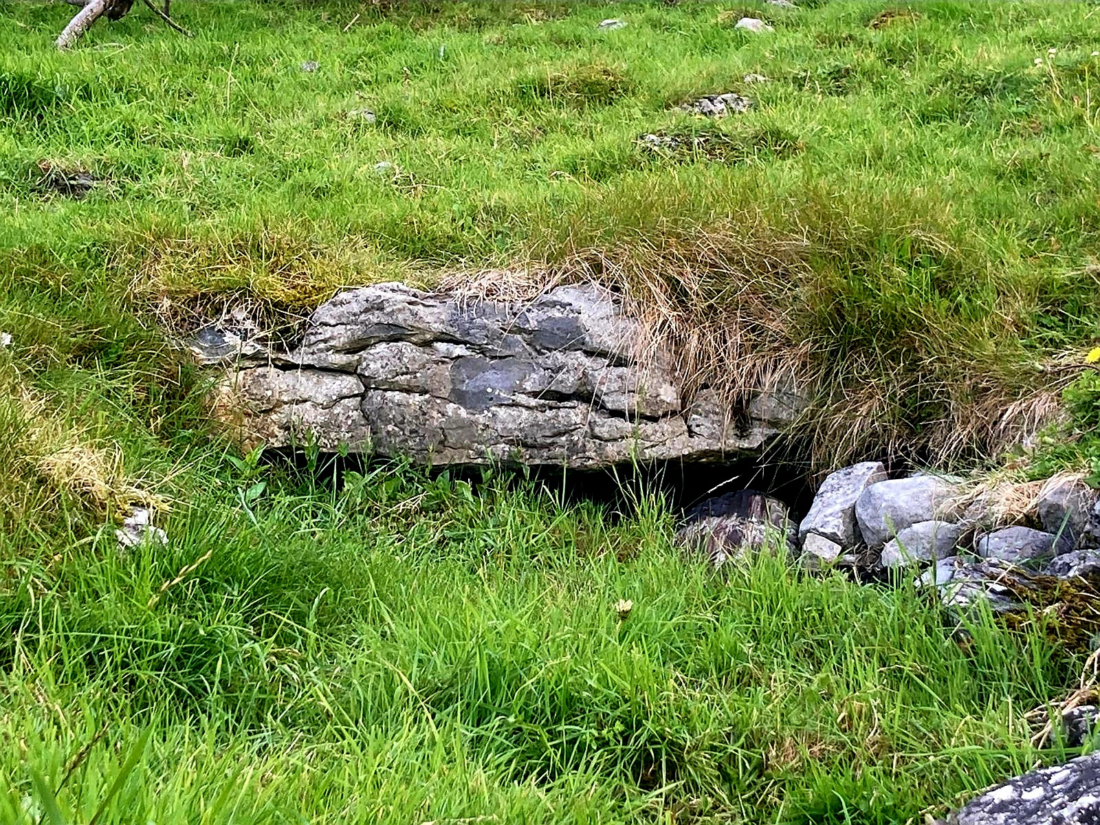
Souterrain (GA056-013001-)
Located within W half of ringfort (GA056-013—-). A trapezoidal drystone-built chamber (L 3.2m), running E-W, narrowing towards W end. Present access is through a breach at E end. A line of stones (L 2m) running further E, from E end, suggests that the souterrain originally extended further in this direction.
Ringfort (A056-011—- )
Situated in low-lying grassland. Very poorly preserved circular cashel (D c. 45m) defined by a grassed-over drystone wall overlain by a field wall from NW through N to NE. A scarp forms the enclosing element at SW. No visible surface trace survives elsewhere.
Ringfort (GA056-012—-)
Situated on a gentle S-facing slope. Poorly preserved circular cashel (D c. 35m) defined by a drystone wall visible only at NE; elsewhere it is overlain by a field wall. Within the interior, which is densely overgrown, are three ruinous field walls, probably modern.
Ringfort (GA056-014—-)
Situated in a low-lying area of grassland and rock outcrop. Poorly preserved almost circular cashel (D c. 40m) defined by a drystone wall. A field wall cuts the monument at NE and SW and no visible surface trace survives to NW of it. Two circular houses (GA056-017—-) lie c. 30m to E and NE respectively.
Mound (GA056-015—- )
Situated in gently undulating grassland. Marked on 1st ed. of OS 6-inch map as a circular enclosure (D c. 50m) in the corner of a field. What is visible is a low flat-topped earthen mound (WSW-ENE 67.1m, H 1.5m max.), oval in plan, its edges only faintly defined save in N sector.
Sweathouse (A056-016—- )
House (GA056-017—-)
Located some 30m to E and NE of a ringfort (GA056-014—-). A much-ruined circular house (D 12m) defined by a double drystone wall and a rubble core; best preserved from NW to SE. A rectangular structure (Wth 1.4m) built into the wall at WNW may be a later insertion. A similar house (D 5.8m, H 0.75m) lies immediately to SE. A gap at NW may be original.
House (GA056-017001-)
The above descriptions are derived from the published ‘Archaeological Inventory of County Galway Vol. II – North Galway’. Compiled by Olive Alcock, Kathy de hÓra and Paul Gosling (Dublin: Stationery Office, 1999). Date of upload: 05 August 2010
Please note: All of the monuments and historical sites listed here are on private property and should not be accessed or entered without prior permission from the landowner.
Comments about this page
Hi Michael – thank you so much for your comment. We would be happy to help if we can. You can email us on [email protected]. Claire
I am in the process of doing a family search. This is a challenge as I am the last man standing if you will and there has been mention of Bally Donnellan in old correspondence. Can you help me, or guide my investigative efforts in my quest, contacts etc? Thank you
Thank you for this excellent posting:
Add a comment about this page