Abbeytown Monuments


National Monuments Service
According to the National Monuments Service, there are a number of monuments in Abbeytown, many of them associated with the ruined abbey. These include an ecclesiastical enclosure, church, graveyard, field system and a number of houses.
Ecclesiastical enclosure (GA042-001001)
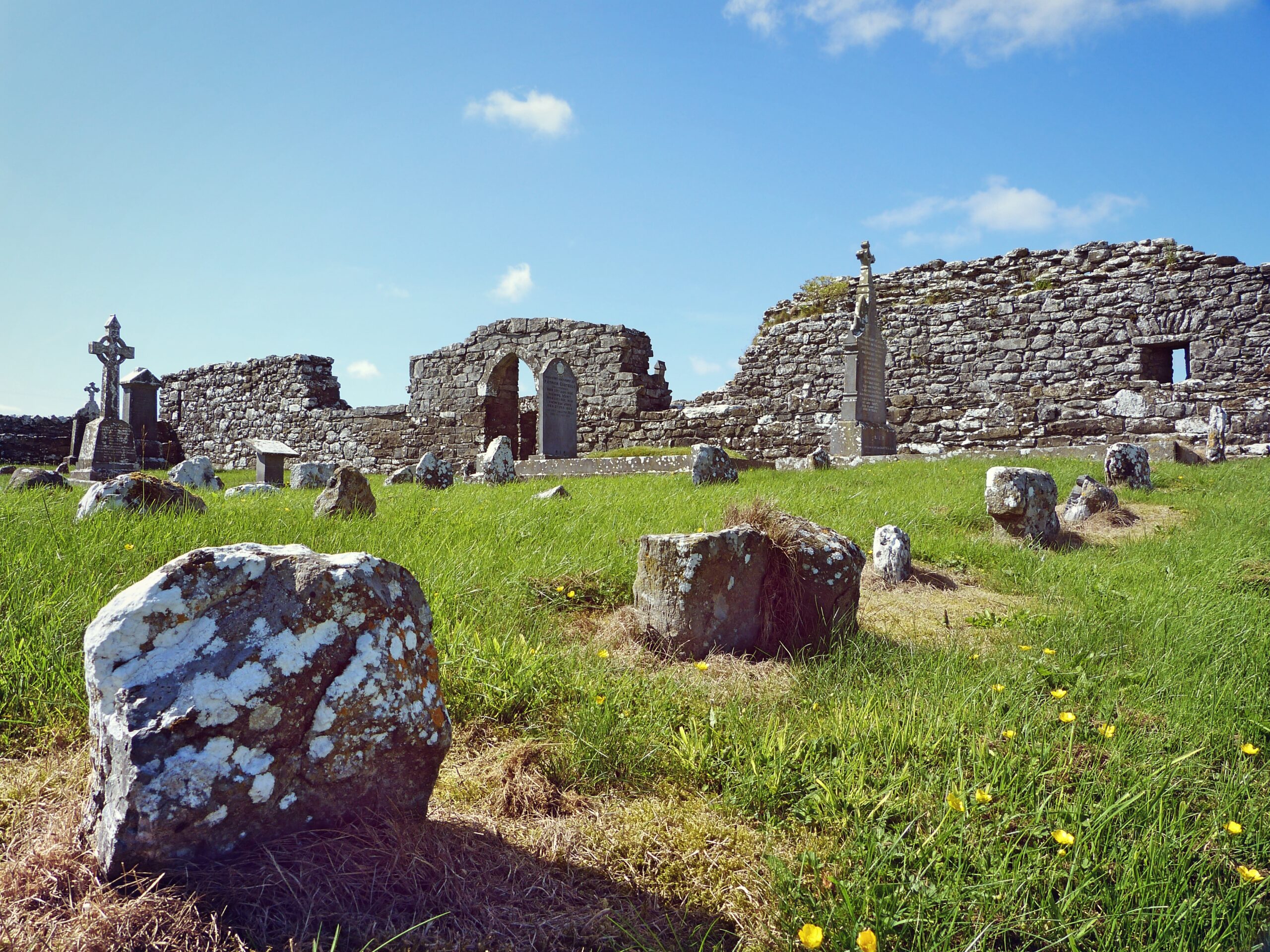
Associated with a field system (GA042-001005-). Amongst the earthworks noted during aerial reconnaissance in January 1985 (ASGAP 211:37, 42) was a strongly curving fosse-like feature to N of the possible church (GA042-001002-). Though evidently much defaced and apparently overlain by the field system, it appears to comprise a shallow fosse with intermittent traces of a stony bank along its inner, or S, edge. Roughly centred on the church, it is visible from WNW through N to NE (D c. 140m). This is probably the same feature as the ‘large arc of [a] … cashel type wall’ recorded by Higgins and McHugh (1990, 66-8) to NE of the church. They describe it as ‘the remains of a substantial stone wall … maximum height 0.33-0.40 metres’ with traces of an external ‘wall facing’.
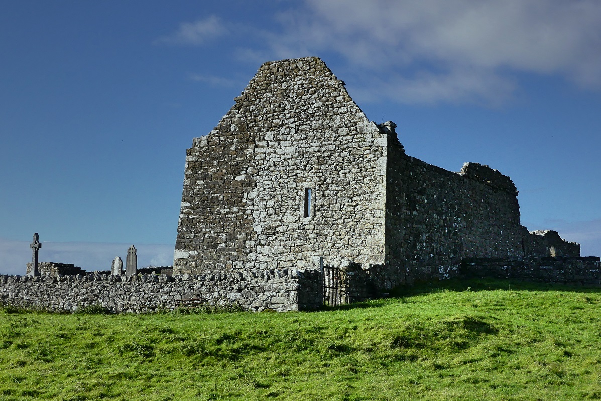
Within a probable early ecclesiastical enclosure (GA042-001001-). According to Grattan-Flood (quoted in Gwynn and Hadcock 1970, 204-5), this was a dependant house of the Premonstratensian abbey at Annaghdown (GA069-001001-), founded ‘in 1260 … on the site of an earlier Celtic mon[astery]’ (see also Higgins and McHugh 1990, 2-7, 68-9). The visible remains comprise a long but poorly preserved rectangular building (E-W; L c. 28.4m, Wth c. 5.9m) which occupies N side of the modern rectangular graveyard. Only its E gable, a stretch of N wall and a fragment at SE corner survive to full height. Excavations by Higgins and Mc Hugh (ibid., 21-65) in the late 1980s identified ‘four main phases’ (ibid., 25) ranging from the 13th to 17th C. Remains of the original doorway, of 13th-C date, were located towards W end of N wall. This was replaced by a W doorway in the 15-16th C, when W gable appears to have been rebuilt (ibid., 37-40). The foundations of two ‘buildings’, probably of 17th-C date, were also uncovered about mid-point along N wall (ibid., 22-6). The larger, interpreted as ‘a north transept’ (N-S c. 7.3m, E-W c. 5.1m), was abutted on E side by a possible ‘sacristy’ (N-S c. 4.9m, E-W c. 3.5m). The existence of two small windows in the surviving fabric at SW corner (ibid., 26-7, 65) indicate that there was once two storeys at this end. There is a small rectangular single-light window, of 17th-C date, in the surviving section of N wall, and another set off-centre in E gable. Their positioning and the striking basal plinth of E gable suggest that in its latest phase(s), this may have been a secular building rather than a church. Traces of walls were also noted in SW part of the graveyard. The finds included a number of medieval querns and graveslabs. (Nolan 1901b, 123; O’Flanagan 1927, Vol. 1, 160)
Field system (GA042-001005)
On a slight rise in undulating grassland. Aerial reconnaissance in July 1968 (CUCAP AVM 76) revealed a series of faint earthworks around a church (GA042-001002-) and graveyard. By January 1985 (ASGAP 211:37-42), the fields to E and S of the graveyard had been reclaimed and the earthworks survived only in the field immediately to N. These comprise a complex series of low earthen banks, trenches and cultivation ridges covering an area 160m E-W by 150m N-S. A number of small irregular fields, coeval with the ridges, are discernible. Three or four possible house foundations, rectangular in plan, are also visible. Higgins and McHugh (1990, 67) also noted ‘two low crescentic structures’ in this area tentatively classifying them as ‘small site huts’. According to local tradition, these earthworks ‘contain remains of the old village of Kilnamanagh’ (ibid.). They also appear to be associated with a probable early ecclesiastical enclosure (GA042-001001-).
The above descriptions are all derived from the published ‘Archaeological Inventory of County Galway Vol. II – North Galway’. Compiled by Olive Alcock, Kathy de hÓra and Paul Gosling (Dublin: Stationery Office, 1999). Date of upload: 05 August 2010”
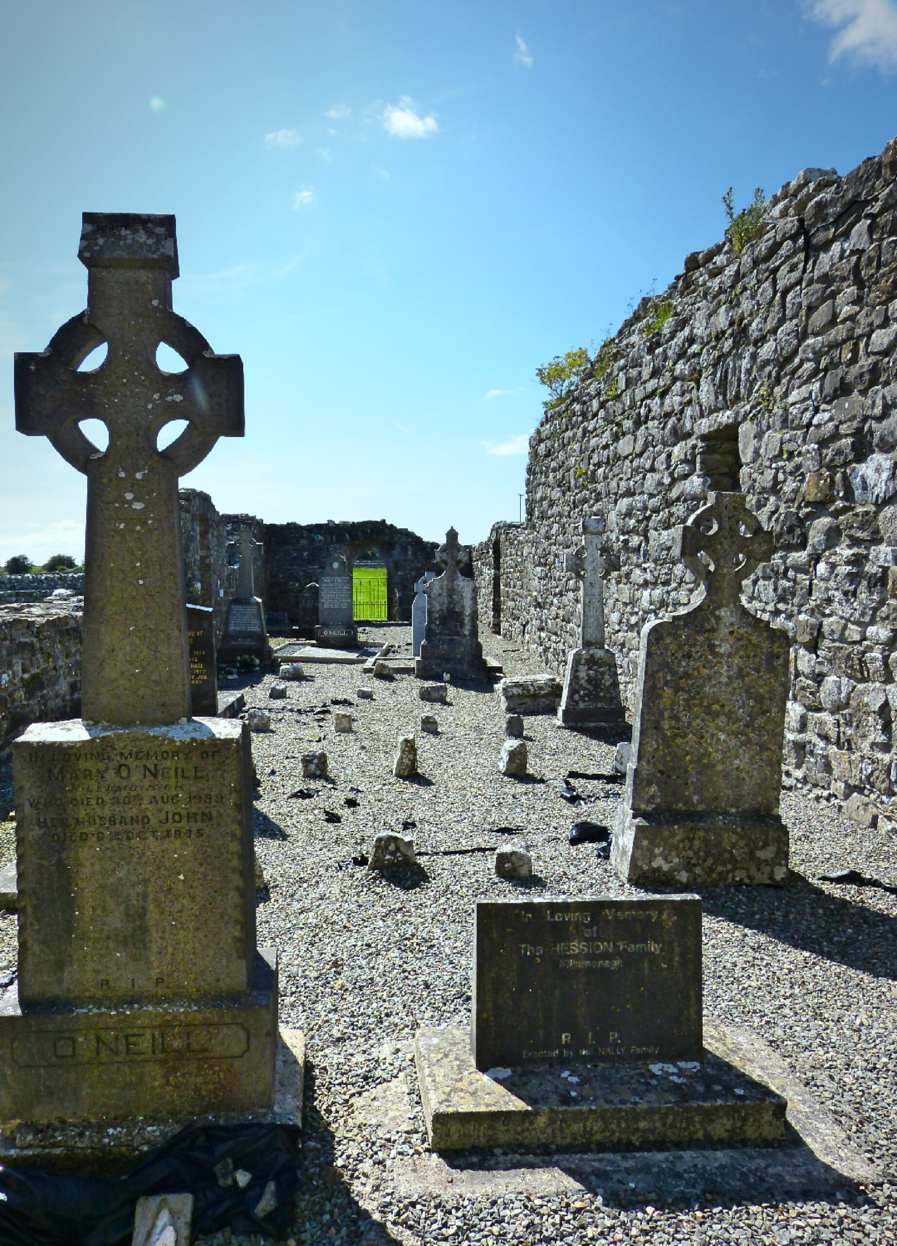
- Graveyard (GA042-001003)
- House – 18th/19th century (GA042-003)
- Grave slab (GA042-001004)
- House – indeterminate date (GA042-001006)
- House – indeterminate date (GA042-001007)
- House – indeterminate date (GA042-001008)
- House – indeterminate date (GA042-001009)
- Hut site (GA042-001010)
- Hut site (GA042-001011)
National Inventory of Architectural Heritage
One thatched house in Abbeytown appears on the National Inventory of Architectural Heritage. Houses such as these are an example of the vernacular architecture once common in rural Ireland, their numbers have decreased significantly since the turn of the 20th century.
Thatched House
Description
“Detached five-bay single-storey vernacular house, built c.1800, having dormer attic, projecting gabled timber porch to front, and lean-to extensions to rear. Pitched thatched roof with shallow raised ridge and low rendered chimneystacks. Whitewashed battered walls with render plinth. Square-headed replacement timber windows with moulded render surrounds and limestone sills. Porch has heart ornament to valence at front, and metal roof, glazed upper parts to sides, and double-leaf glazed timber door. Double-leaf wrought-iron vehicular gate to west leading to yard at rear, and garden to front bounded by hedge over rendered wall and having pedestrian gate with rubble limestone piers and ornate cast-iron gate.”
Appraisal
“This is a good example of a longer than usual thatched vernacular house. Its setting significantly enhances the building, and the addition of the simple but elegant timber porch adds interest. The cast-iron and wrought-iron gates also add to the setting and display the craft of traditional metalworkers.” (Source: National Built Heritage Service)
Database of Irish Excavation Reports
A detailed description of the excavations carried out at Abbeytown Abbey in 1989 by the Donaghpatrick Kilcoona Heritage, as part of the FÁS training scheme, can be found at the following link: Kilnamonagh Excavations.
Please note: Many of the monuments and historical sites listed here are on private property and should not be accessed or entered without prior permission from the landowner.
No Comments
Add a comment about this page