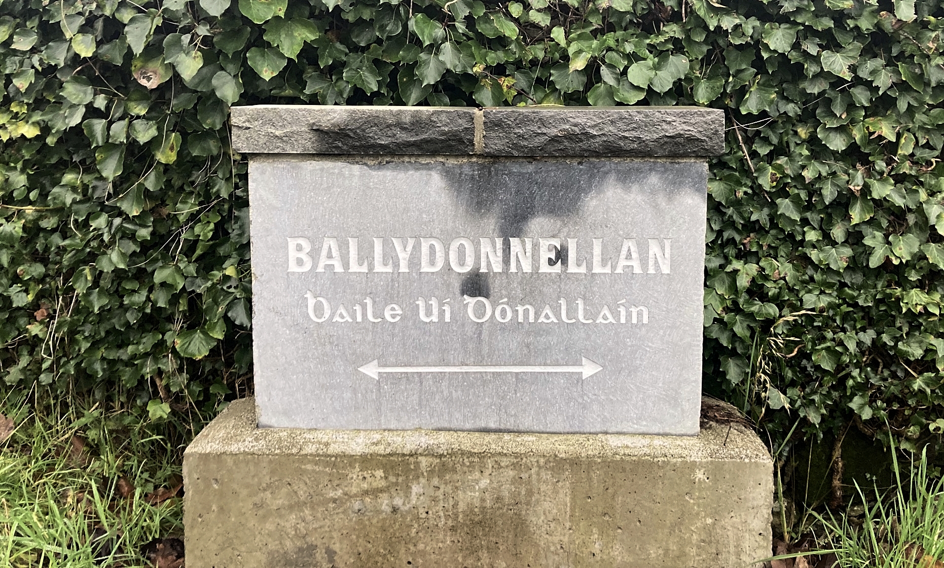
Ballydonnellan (Baile Uí Dhónalláin)


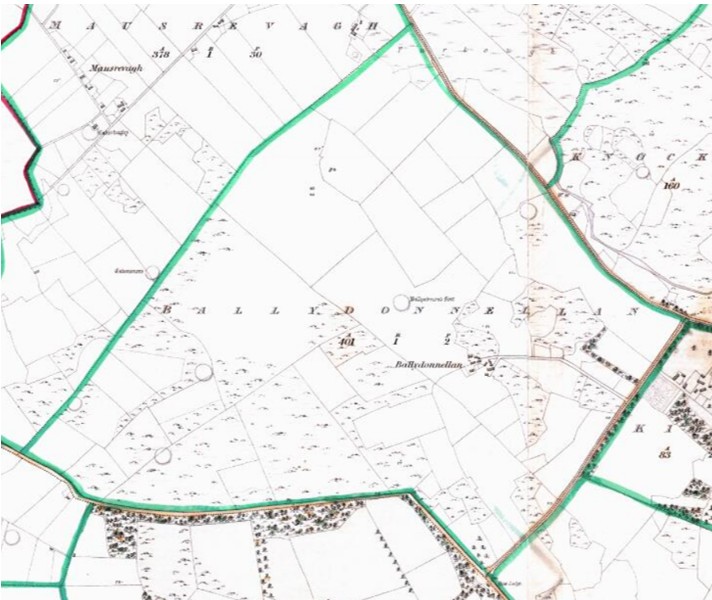
The name Ballydonnellan comes from the Irish Baile Uí Dhónalláin, meaning the townland of Ó Dónalláin. It is situated in the civil parish of Kilcoona, Barony of Clare. It is located in the south of the parish and is bounded on the east by Ballynew, Kilcoona, Kilroe and Knockereen, on the west by Luimnagh West and Mausrevagh and on the south by Ballinduff. (Source: Galway Library)
Irish name: Baile Uí Dhónalláin
English name: Ballydonnellan
Meaning: The townland of Ó Dónalláin
Area: 401 Acres, 1 rood, 2 perches
Field names:
Civil Parish: Kilcoona
Barony: Clare
O’Donovan’s Field Name Books
As part of the Ordnance Survey of Ireland, from 1830 to 1842, John O’Donovan helped to collect and record the Irish form of townland names throughout the country. Information for each townland was collected and written into the Name Book along with information relating to land quality, crops and housing. (Source: Timeline Genealogy)
Other names: Ballydonnellan, Baile Ui Dhomhnalláin, Ballydonnellan (By. Surveyors Sketch Map), Ballydonnelan (County Map), Ballydonnellon (Couty Cess Collector), Ballydonnellan (Inq. Temp. Car. I), Ballydonellan (Inq. Temp. Jac. I), Ballydonnellon (Local), Ballydonnellon (Mearsman), Baladonnellon (Rental), Ballydonnelan (Rev. John Molloy, P.P.) and Ballydonnelan (Tithe Ledger)
Description: Proprietor Robert French, Esq., Rasen. Agent John Blake, Esq., of Minlow, both Co. Galway. All held under a lease of lives by Timothy Hanly of Kilroe at 10s. sublet at a rent of from 14 to 15 shillings per acre. Farms from 3 to 20 acres. Soil light and rocky produces light crops, wheat and potatoes. Co. Cess 14d. per acre half yearly. Antiquities 5 forts one called Bally Edmund Fort.
Other placenames in this townland
Ballydonnellon A village in S.E. part of townland, meaning O’Donnellan’s Town. Other forms of the name are Ballydonnellon Local.
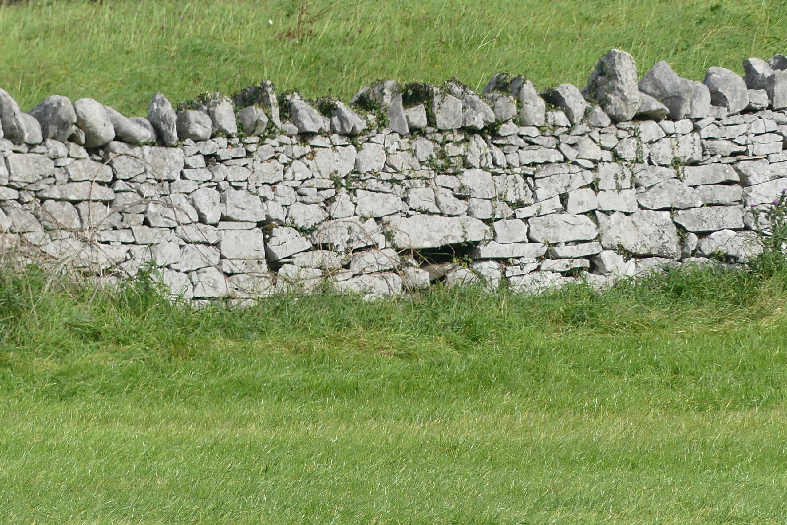
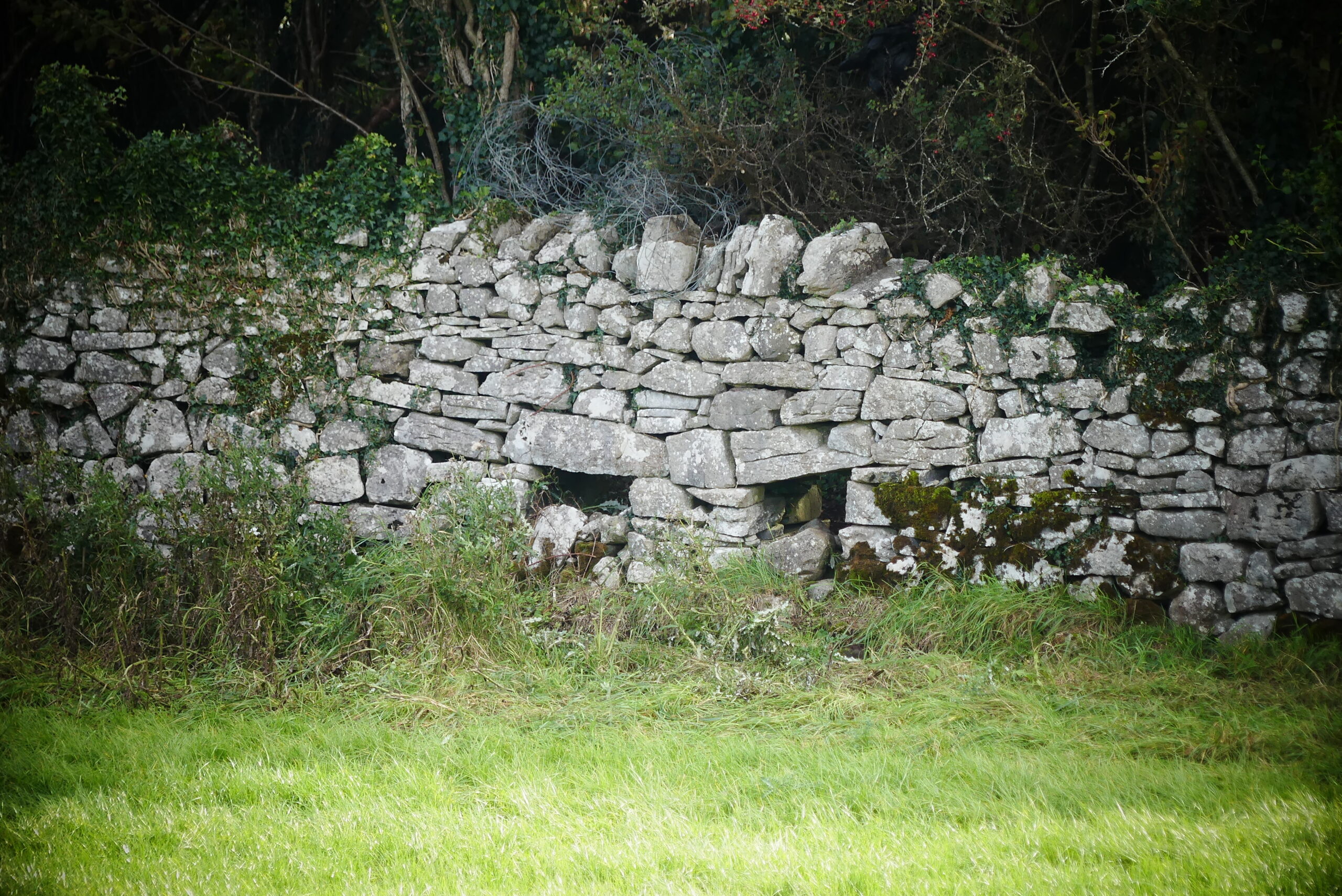
Ballyedmond A fort having a cave, a small distance N. of Ballydonnellon Village, having another fort W. of it and N. of the village but has no name given to it. Other Forms of the name include Ballyedmond, Baile Eamoin (its Irish form) and Ballyedmund Fort Local.
The Down Survey
The first national-scale survey of its kind in the world, the Down Survey, taken in the years 1656 -1658, sought to acurately map the land in Ireland in order to facilitate its transfer from Irish Catholics to English Protestants after the Cromwellian conquest.
1641 (pre-Cromwell) states that the owner(s) of the townland of Ballydonnellan (Referred to as Ballahenein the Down Survey of Ireland, in the Parish of Killcoonagh in the county of Galway, Barony of Clare) was Edmund Skerret (Catholic). The Down Survey map of 1670 (post-Cromwell) shows that the owner(s) was Stephen Skelton (Catholic).
72 plantation acres was deemed unprofitable land.
81 plantation acres was deemed profitable land
81 plantation acres was fortified land
Tithe Applotment Book 1826
The Tithe Applotment Books were compiled between 1823 and 1837 in order to determine the amount which occupiers of agricultural holdings over one acre should pay in tithes to the Church of Ireland. The land was measured in Irish acres, or plantation acres at the time. This equated to 1.698 English acres.
There were no records found for Ballydonnellan.
Valuation Office Books 1824-1856: House & Field Books
The valuation of Ireland was a cadastral survey made for the purpose of levying tax on property. A valuation price was put on every piece of property in the country and this became the basis on which local tax was charged, at a rate per pound of valuation. (Source: National Archives)
The 1853 House Books show the following as house occupier in Ballydonnellan as John Gunning (06 September 1853). John Gunning occupied a Herd’s House and Offices that had an initial valuation of £1 and 13 shillings which was reduced to 16 shillings by the valuator. (Source: National Archives)
1855 Griffith’s Valuation
Between 1847 and 1864, Richard Griffith was responsible for carrying out the Primary Valuation of Tenements (generally referred to as Griffith’s Valuation because of his role in the project). The aim of the valuation was to produce a uniform guide to the relative value of land throughout the whole of Ireland in order to decide liability to pay the Poor rate (for support of the poor and destitute within each Poor Law Union). The project required Griffith and a team of valuers to determine the value of every piece of land and property in the country enabling every occupiers’ tax due to be assessed. The information they collated covering all 32 counties was compiled into over 300 volumes and published over a period of 17 years. (Source: Find My Past)
Griffith’s Valuation records one house in Ballydonnellan, occupied by John J. Gunning. (Source: Ask About Ireland)
John J. Gunning occupied a herd’s house with offices, and land totalling 401 acres, 1 rood and 2 perches. The properties were held ‘In Fee’* by John J. Gunning. The annual valuation for the land was £144 and £1 for the buildings.
* Lands held ‘in fee’ were freehold tenures, derived from a grant from the Crown.
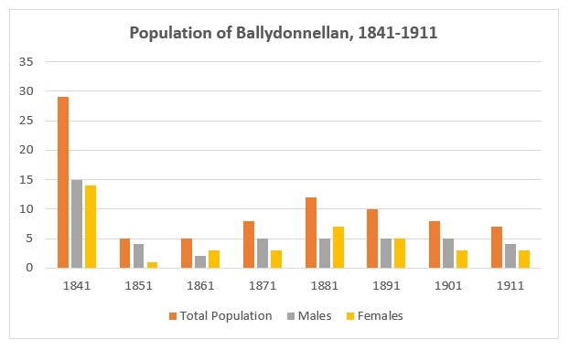
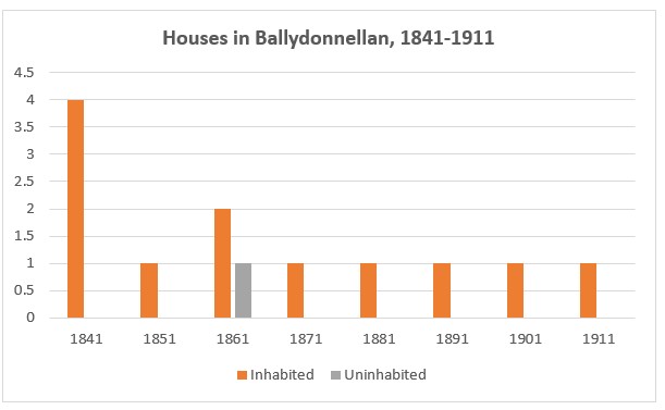
Population Statistics
The following statistics are from the census return records from 1842 to 1891 and the National Archives census returns for 1901 and 1911. (Source: Histpop)
1841: 4 houses, 29 people (15 males and 14 females)
1851: 1 house, 5 people (4 males and 1 females)
1861: 2 houses (incl.1 unoccupied), 5 people (2 males and 3 females)
1871: 1 house, 8 people (5 males and 3 females)
1881: 1 house, 12 people (5 males and 7 females)
1891: 1 house, 10 people (5 males and 5 females)
1901: 1 house, 8 people (5 males and 3 females)
1911: 1 house, 7 people (4 males and 3 females)
1901 Census
The 1901 Census of Ireland records the following 8 individuals living in 1 household in Ballydonnellan. (Source: National Archives)
1. Michael Reilly (72) lived with his wife Honor (61), sons Thomas (38), Luke (33), Patrick (30) and Willie (18), and daughters Bridget (28) and Anne (21). All householders were born in Co Galway and all were Roman Catholic. Michael’s occupation was listed as a Farmer, Honor as a Farmer’s Wife, Thomas, Luke, Patrick and Willie were listed as Farmer’s Son while Bridget and Anne were listed as Farmer’s Daughter. Michael and Honor could not read or write, the remaining householders could read and write. All householders could speak Irish and English.
There was one second class house in Ballydonnellan in 1901. The house had either a roof of thatched, wood or other perishable material. The house had walls constructed of either brick, stone or concrete. The second-class house had three front windows.
There was no information on out-offices and farm steadings.
1911 Census
There was 1 house in Ballydonnellan with a total of 7 individuals recorded in the 1911 Census of Ireland. (Source: National Archives)
1. Michael Reilly (82) lived with his wife of 49 years Honor (72), sons Thomas (48), Patrick (41) and Willie (28), daughter Annie (30), and female cousin Delia Lee (9). All householders were born in Co Galway and all were Roman Catholic. Michael’s occupation was listed as a Farmer, Honor as a Farmer’s Wife, Thomas, Patrick and Willie were listed as Farmer’s Son while Annie was listed as Farmer’s Daughter. Their cousin Delia Lee was listed as a School Girl. Under the heading Specified Illness, both Michale and Honor are documented as deaf.
There was one second class house in Ballydonnellan in 1911. The house had either a roof of thatched, wood or other perishable material. The house had walls constructed of either brick, stone or concrete. The second-class house had three front windows. There was 1 stable, 1 cow house, 1 calf house, 1 piggery, 1 fowl house, 1 barn and 1 shed.
No Comments
Add a comment about this page