Ballinvoher Monuments

According to the National Monuments Service, there are two existing standing stones in Ballinhover townland, with a possible third, although this entry is now attributed to the existing stones.
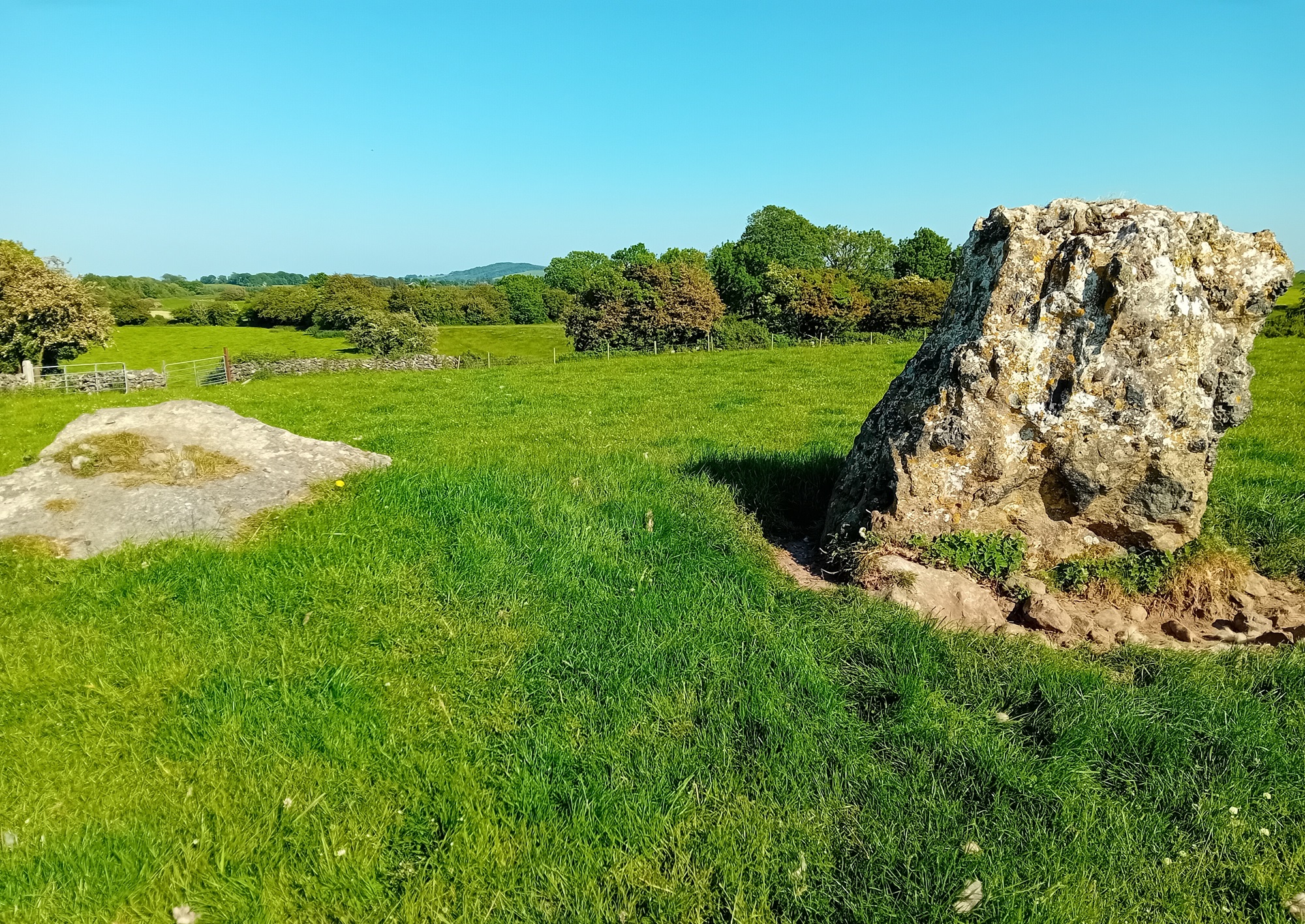
Standing Stone – Pair (GA042-010—-)
On a slight rise in grassland. Marked on 3rd ed. of OS 6-inch map (1920) as three small dots aligned NE-SW. It consists two large eroded limestone slabs aligned as on map and set 2.2m apart. Both are subrectangular in plan, but N stone (L 1.9m) is now prostrate. Like S stone (H 1.8m), it appears to have been formerly held in place by basal-packing stones. An unclassified stone structure (GA042-011—-) lay 325m to S.
Standing stone (GA042-011—-)
In undulating grassland, 325m S of a stone pair (GA042-010—-). Marked on 1st ed. of OS 6-inch map and named thereon as ‘Cloghbrack’. However, it does not appear on 3rd ed. (1920), where the name is now applied to the above-mentioned stone pair. No visible surface trace survives.
The above descriptions are derived from the published ‘Archaeological Inventory of County Galway Vol. II – North Galway’. Compiled by Olive Alcock, Kathy de hÓra and Paul Gosling (Dublin: Stationery Office, 1999). Date of upload: 05 August 2010
Please note: Both standing stones listed here are on private property and should not be accessed or entered without prior permission from the landowner.
No Comments
Add a comment about this page