
Situation:
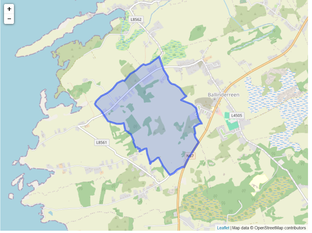
The standard name for the townland was Mulroog East with the Irish name being Maol Ruag. The townland was at the west of the parish. It was bounded on the north by Drumacoo Parish, Drumacoo and Gurtarova on the east, Killeenavara on the south and Mulrooag west on the west.
Description:
The proprietor was A.F. St. George of Tyrone House, and the agent was J. O’Hara. It was occupied by 21 tenants some of which had a lifelong lease. The rent was one pound per acre. Most of the land was uncultivated or rocky. North of the townland was two villages named Mulroogarran and Cappaghloughlin.
The name given to the townland in the survey was Moilerock. The owner in 1641 was William O’Shaughnesse who was catholic. And in 1670 the owner was Jeoffrey French who was also catholic. No other information was given.
Map reference one consists of John Flaherty, Patrick Larkin, Martin Quinn, Terence Sheil, Patrick Flaherty, Eleanor Burke, Daniel Gibbons. Sarah Furdom, Michael Flaherty, Thomas Donohoe, John Flaherty, Joseph Flaherty, James Flaherty, Thomas Flaherty, John McDonough. John Tierney, Bartholomew Brennan and Patrick Toole. The land was 101 acres and 1 rood. It was worth 24 pounds and 225 shillings. The landlord was Christopher St. George.
Map reference two was Terence Sheil and John Quinn. This land was 8 acres and 33 perches. This was worth 2 pounds and 20 shillings. The landlord was the same as before.
Map reference three was John Grady. This land was 7 acres and was worth 3 pounds. The landlord was the same as before.
Map reference four was John Connor. This land was 5 acres, 3 roods and 18 perches. It was worth 2 pounds and the landlord was the same as before.
Map reference was five Michael Mannion. This house and land was 2 acres, 2 roods and 8 perches and was worth 1 pound and 10 shillings. The landlord was the same as before.
Map reference six was Martin Kelly. The house and land was 9 acres and was worth 5 pounds and 10 shillings.
Map reference seven was John Fitzgerald. The house, office and land was 33 acres and 17 perches and was worth 16 pounds and 10 shillings. The landlord was the same as before.
Map reference eight and nine belonged to Bryan Lennane. Map reference eight was the land which was 2 acres and 38 perches. Map reference nine was the house and land which was 3 acres, 3 roods and 10 perches. It was worth 4 pounds and the landlord was the same as before.
Map reference ten was Bridget Nyland and Margaret Lennane. The house and land was 2 acres, 3 roods and 58 perches. This was worth 1 pound and 20 shillings.
Map reference eleven was Thomas Flaherty. The land was 9 acres and 33 perches which was worth 4 pounds and 15 shillings.
Map reference twelve was Walter Martin. This was 9 acres and 32 perches which was worth 2 pounds.
Map reference thirteen was Margaret Lennane. This land was 4 acres, 2 roods and 15 perches. It was worth 1 pound and 5 shillings.
Map reference fourteen was Owen Sweeney. This land was 27 acres, 2 roods and 20 perches. This was worth 11 pounds and 10 shillings.
Map reference fifteen and sixteen was Patrick Lennane. Reference fifteen was land and sixteen was land also. Fifteen was 122 acres, 1 rood and 14 perches and sixteen was 12 acres, 2 roods and 33 perches. This was worth 8 pounds overall.
Map reference seventeen and eighteen was Bartholomew Sheehan. Seventeen was land that was 27 acres, 2 roods and 23 perches and eighteen was 1 rood and 29 perches. Overall, this was worth 9 pounds.
Map reference nineteen was James Lennane. This was 13 acres, 1 rood and 30 perches. It was worth 4 pounds.
Map reference twenty and twenty one was Lawrence Connolly. Twenty was land around 7 acres and 38 perches, with twenty one being land around 14 acres, 1 rood and 36 perches. This was worth 8 pounds and 10 shillings.
Map reference twenty two was Patrick Lannan and John Lennane. This was 17 acres and 2 roods and 37 perches. This was worth 4 pounds.
Map reference twenty three was Michael Lennane. This was 4 acres, 1 roods and 8 perches. This was worth 1 pound.
Map reference twenty four was John Lennane. This land was 3 acres, 3 roods and 21 perches. This was worth 1 pound and 5 shillings.
Map reference twenty five was Joseph Lennane and Mary Tannian. This land was 6 acres, 4 roods and 8 roods. This was worth 2 pounds and 5 shillings. Josephs Landlord was the same as before and Mary payed Joseph for accommodation.
Map reference twenty six was Peter Lane. The land was 1 acre, 3 roods and 6 perches and was worth 10 shillings. The landlord was Christopher St. George.
Map reference twenty seven was Michael Lennane. This land was 1 acres and 34 perches and was worth 7 shillings. The landlord was the same as before.
Map reference twenty eight was Mary Clasby. This house and land was 2 roods and 22 perches and was worth 1 pound.
Map reference twenty nine was Mary Burke. This house and land was 9 acres, 3 roods and 10 perches and was worth 3 pounds and 10 shillings.
Map reference thirty was Patrick Lennane. The land was 2 acres, 1 rood and 18 perches and was worth 5 shillings.
Map reference thirty one was Owen Gibbons. The land was 7 acres and 2 roods and was worth 3 pounds and 5 shillings.
Map reference thirty two was Martin Lennane. This land was 1 acres, 1 rood and 23 perches and was worth 10 shillings.
1911 census
In 1911 there were four households in the Mulroog region. There are 18 individuals who are all roman catholic with 9 males and nine females. All were born in county Galway except Mary Fahy in house two who was born in America. The census shows that all four houses were built as a private dwelling[1], they were all built the same way with Stone or brick walls, Wood or thatch roofs, two rooms and three windows all being second class dwellings. Each of the heads of family owned the holdings to the house. There were 15 farm steadings with house one having a stable, a piggery and a barn. House two having a stable, cow house, calf house, piggery and a barn. House three had a stable, fowl house and a barn. House four had a stable, cow house and a piggery and a barn.
Patrick Niland (80) was the head of family of house one, he was a widower and lived with his family. His son Patrick (53), Daughter Mary Kiely (50) and extended family. His son in law John Kiely (48) and grand children Bridget (13), Mary (11) and Winnie (9). Patrick worked as a farmer and his son as a farmer’s son. John as a farm labourer and the grandchildren as Scholars. Each of them could read and write except the younger Patrick who could not read. All of them except Winnie could speak Irish and English.
Willian Fitzgerald (41) was the head of family of house two. He lived with his wife Kate (36) and Mother Mary (70) and his children and niece. He had three sons John (3), Thomas (2) and William (4 months). His niece Mary Fahy (19) also lived with them. William worked as a farmer and his children as Farmer’s sons. All of them except his three sons could read and write and could speak Irish and English.
Michael Linnane (64) was the head of family of house three and he lived with his wife Bridget (58). They had been married for 15 years but did not claim to have any children. Michael worked as a farmer and both of them could read and write and speak Irish and English.
Michael Clayton (40) was the head of family of house four and lived with his sister Bridget (30). Both of them were single and Michael worked as a farmer. Both could speak Irish and English and could read and write.
[1] I find the writing of the household form hard to read but I believe it is meant to imply that the results are the same as the entry above it
No Comments
Add a comment about this page